Spatio-temporal dynamic modeling of plant communities responses to hydrological pressures in a semiarid Mediterranean wetland
2Applied Biology Dept. University Miguel Hernandez (Elche, Spain)
3ITC - University of Twente (Enschede, The Netherlands)

1 Introduction
Study area
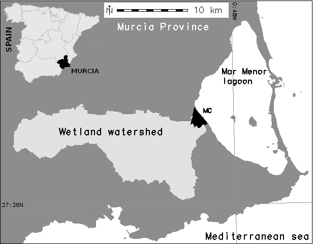
Marina del Carmoli wetland (300 ha)
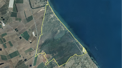
Wetland plant communities
Semiarid Mediterranean saline wetlands are semi-terrestrial ecosystems
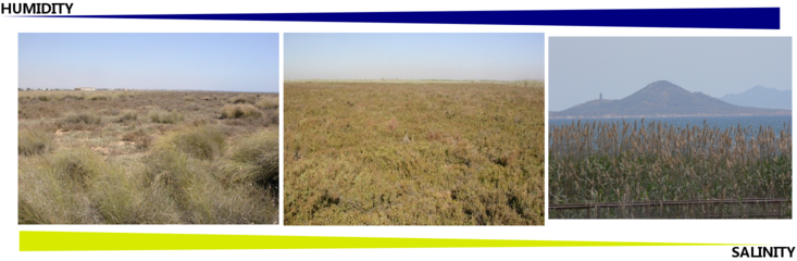
-
Salt steppe (left) - priority habitat by the Habitats Directive
Salt marsh (center) - habitat of interest by the HD
Reed beds (right) (Phragmites australis) - invasive
External water inputs
Percentage of irrigated areas has increased in the last decades due to the opening of a water transfer (Martínez-López et al., 2013)
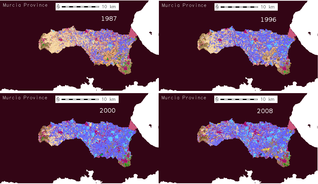
Plant communities change
Important plant communities are being lost!
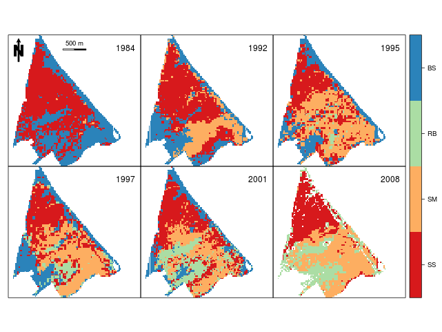
Carreño et al., 2008; Martínez-López et al., 2012
Objective
-
Spatially explicit wetland model of how irrigated agriculture is affecting plant community composition in this semiarid Mediterranean wetland
2 Methods
Modelling environment
-
R as a modelling environment:
-
GIS capabilities
source code is flexible
free availabity and growing user community
-

State variables
-
Wetland is divided into pixels (25 m)
Plant communities are modelled separately pixel by pixel (4 maps)
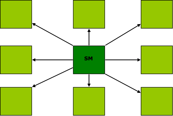
The total abundance of plant communities within a pixel is limited so:
-
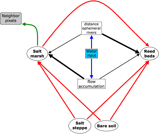
competition among plant communities mediated by
-
total drainge water input to the wetland
spatial environmental variables influencing water availability and growth
the dispersion of other PC from the surrounding pixels
-
-
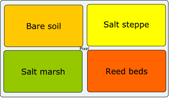
Initial and validation maps of plant communities
Model was tested by means of remote sensing data for the period 1992-2008
Carreño et al., 2008; Martínez-López et al., 2012
Model assumptions I
-
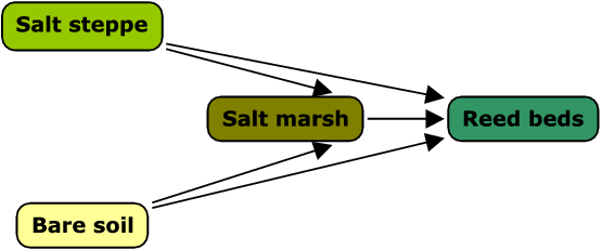
Increasing water input
Only conversion to more humid / less saline plant communities
Model assumptions II
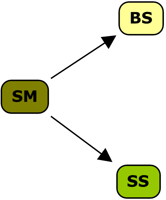
native vs. invasive taxa
-
invasive reed beds are potentially present in all pixels
salt marsh is able to disperse into neighbour pixels
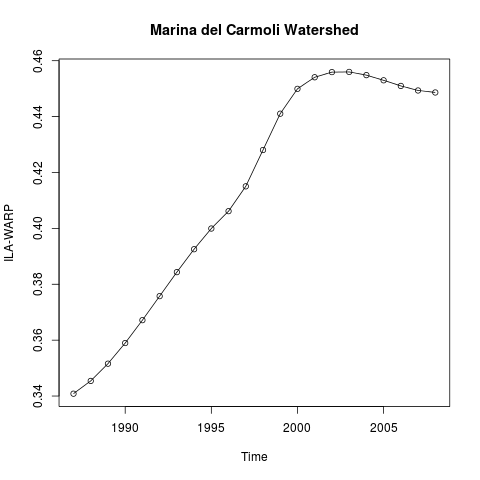
Non spatial forcing input
Drainage water input
WARP index (Martínez-López et al., 2014a,b)
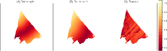
Wetland environmental spatial parameters
-
(A) distance map to ephemeral river 1 (reed beds)
(B) distance map to ephemeral river 2 (reed beds)
(C) Flow accumulation map (salt marsh)
-
All parameters are on a relative 0–1 scale.
Model diagram
Model development/execution
- 1.
Initial dynamic model was developed using Stella (1 pixel)
- 2.
Conversion to R using ’StellaR’ script (Naimi and Voinov, 2012)
- 3.
State variables and spatial environmental variables as matrices
- 4.
Model wrapped as a R function
- 5.
ode.2D("euler" method, time = 24 year, TS = 0.25) (library "deSolve")
3 Conclusions
Conclusions
- 1.
The model serves as a tool for
- 2.
wetland conservation and management studies (habitat loss)
- 3.
testing plant community interactions
- 4.
testing relationships between plant communities and environmental variables in space and time
- 2.
- 5.
The library undergoes further developments in order to become a flexible tool for the development of new spatio-dynamic models